Skip to content
Search
Menu

These bookings pay us a commission through Viator. Your price does not change, and neither did our picks because of it.

Water feature

Lake Blue Ridge

Last updated

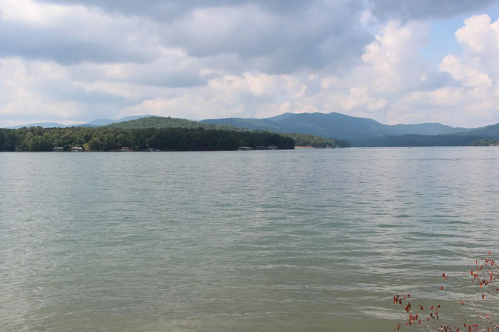
Thirty-three hundred acres of cold green water with national forest around most of it, and a level that TVA moves by dozens of feet a year.

Photo: Thomson200CC0

The Tennessee Valley Authority closed the Toccoa River behind a 175-foot concrete dam in 1930 and backed up roughly 3,300 acres of water into the valleys south-east of Blue Ridge. That single decision produced most of what the county sells today: about sixty miles of shoreline, a reservoir that reaches something like 246 feet deep at the dam, and a ring of steep wooded slopes on which several thousand cabins now sit.

What makes this lake unusual in the Southeast is what is not on it. A large proportion of the shoreline lies inside the Chattahoochee National Forest, which means no development, no seawalls and no lawns running to the water. From a boat in the middle it reads as forest almost the whole way round, broken by the occasional dock and by the coves where private land reaches the bank. It is a genuinely handsome piece of water, and it is quiet compared with the reservoirs closer to Atlanta.

What makes it awkward is the level. This is a working hydroelectric and flood-control reservoir with one 13-megawatt generator, not an ornamental lake, and TVA moves it. Full summer pool sits around 1,686 feet above sea level. Through autumn the agency draws it down, and by late winter the difference is dramatic: mudflats where there was water, ramps ending in gravel, docks resting on the bottom, stumps visible that are a hazard when covered. In 2010 and 2011 TVA took it down to roughly 1,630 feet for a year to repair a penstock, which gives you the scale of what is possible.

The practical consequence is simple. If you are coming for the water, come between late spring and early autumn, and check the current level before you tow a boat up here.

Getting there and parking

The lake wraps around the south-east side of town, and the road you want depends on which arm you are aiming for. Aska Road runs down the western shore and is the route to most of the cabin country and to the Aska trailheads. Old Highway 76 and the Morganton road serve the eastern side and Morganton Point.

The dam end is closest to town, roughly ten minutes from the depot. Morganton Point is nearer twenty. The southern arms, where the Toccoa comes in, are half an hour and the last part of many approaches is gravel.

Be aware that a lakeside cabin does not imply a short drive to a ramp. The shoreline is sixty-odd miles long and folded into coves, so two points a mile apart across the water can be twenty minutes apart by road. Check the driving route, not the map distance, before booking.

The drawdown, and why your photograph looks different

People book a cabin in November on the strength of a July photograph and arrive to find the lake has moved away from the dock. This is the single most common disappointment in Fannin County and it is entirely predictable.

TVA runs Blue Ridge for power, flood storage and downstream flow, not for the view. The reservoir is held near full pool through the warm months and drawn down through the autumn, reaching its low over winter before refilling in spring. The drop is not a few feet. On a steep-sided lake it exposes wide bands of red clay and rock, strands floating docks, and puts the end of several public ramps on dry ground.

None of that makes a winter visit bad. A drawn-down reservoir is a strange and rather beautiful thing, with old road beds, stumps and stonework appearing along the banks. It is simply not a swimming and boating lake at that point.

Two rules. Check the current elevation on TVA's own reservoir information before you tow a boat or book a pontoon. And treat submerged stumps as a real hazard at any level other than full pool, particularly in the upper arms where the old river channel wanders.
Where the public can actually get in

Shoreline that is national forest is undeveloped by design, and shoreline that is private belongs to a cabin. That leaves a small number of public points, and they get busy.

  • Morganton Point Recreation Area, on the eastern side near the community of Morganton, is the Forest Service site most visitors use: campground, beach area, picnic ground and a ramp. It is the closest thing the lake has to a public beach.
  • Ramps are scattered around the lake and several are usable only near full pool. Confirm before hauling a trailer a long way.
  • Blue Ridge Lake Marina sits on the northern end near the dam and is where most rental pontoons come from.
  • Cabin docks are private. A dock visible from a rental listing is not necessarily included with the rental; ask before you book if that matters to you.

Swimming is at your own risk everywhere. There is no lifeguard on this lake. The water is noticeably colder than a Georgia visitor expects in early summer, because it is impounded mountain river at depth, and it stratifies: warm on top, sharply cold a few feet down.

What swims in it

Blue Ridge is best known among Georgia anglers for smallmouth bass, which is not a common thing to say about a lake this far south. The reservoir sits in the Tennessee River drainage rather than the Atlantic or Gulf systems, and the fish community reflects that. Walleye are also present and are a genuine, if patchy, winter and spring fishery.

Alongside those you get largemouth, spotted bass, various panfish, catfish and a long-standing trout presence in the cold water below the thermocline and in the river above the lake. The Toccoa upstream of the reservoir and the tailwater below the dam are both trout water and fish quite differently from the lake itself.

Practical notes rather than tactics. A Georgia fishing licence is required, with a trout stamp for trout water. Rules, sizes and limits are set by the Georgia Department of Natural Resources and change; read the current regulations rather than repeating what somebody said at the ramp. Water clarity here is usually good, which cuts both ways: the fish can see you too.

The deep water near the dam holds fish through the hottest part of summer, which is why you see boats clustered there in July while the coves look empty.

The dam itself, and what it did to the valley

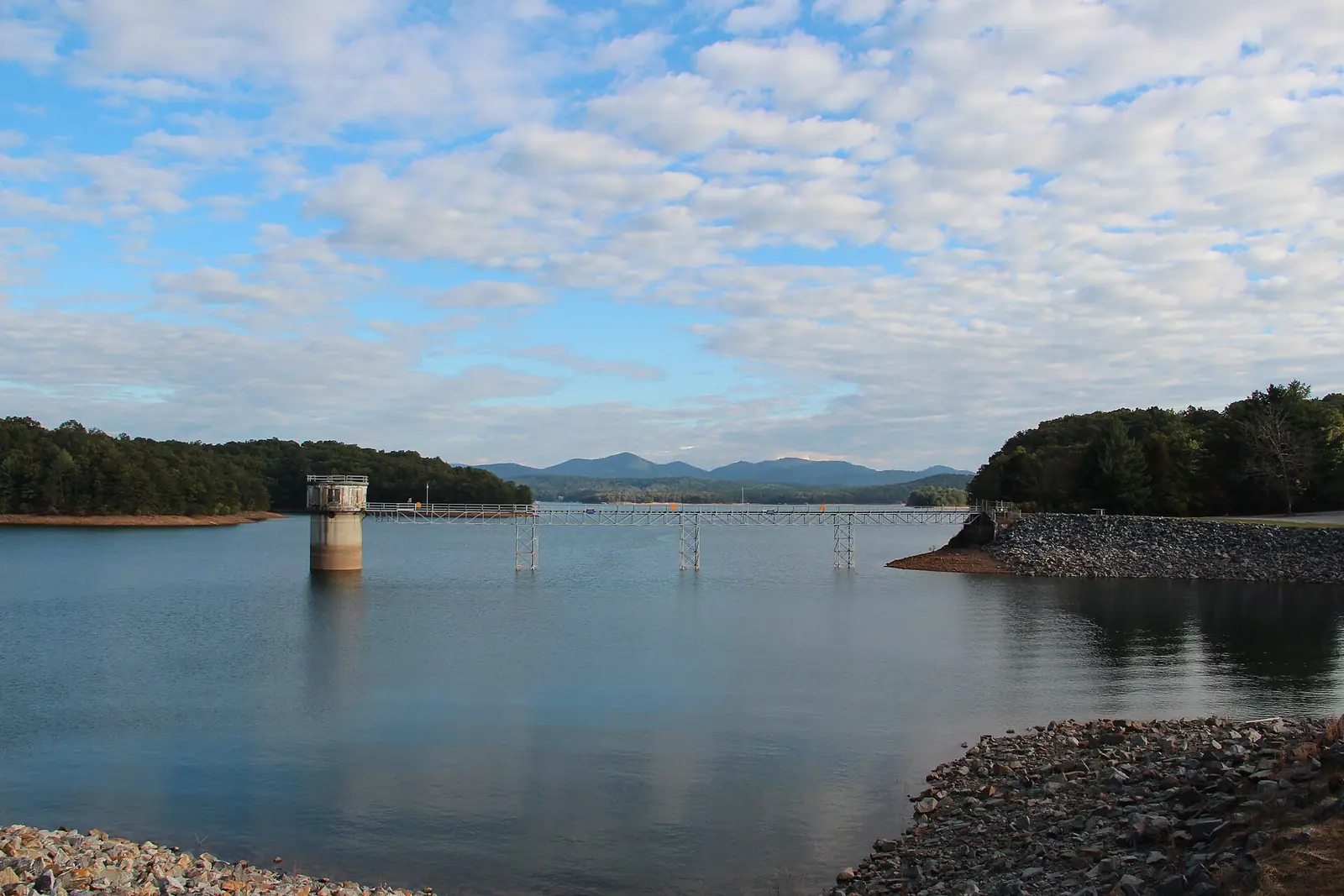
Blue Ridge Dam is a 175-foot concrete structure roughly 1,553 feet across with a single generator rated around 13 megawatts, which is small by TVA standards. It was completed in 1930, before TVA existed, and came into the agency's hands afterwards.

What it flooded is worth a thought as you look at the water. The Toccoa valley above the dam held farms, roads and the sort of scattered settlement that characterised Fannin County before the highway. Fannin was created in 1854 out of parts of Union and Gilmer counties and was, for most of its history, a farming and timber economy with a railroad running through it. The reservoir removed the bottom land, which was the good land, and replaced it with a shoreline economy that took another sixty years to arrive.

You can see the dam from the road on the north end, and the tailwater below it is a popular put-in for float trips down the Toccoa towards McCaysville. Generation schedules affect flow downstream, which matters a great deal if you are in a boat on that stretch. TVA publishes release schedules; check them before floating below the dam rather than after.

Near The Lake

Straight-line distances, so allow more on the road — the island is long and has one main parkway.

  • A timber dock running out to covered boat slips on a calm lake
    Marina

    Blue Ridge Lake Marina

    The lake's main rental and fuel point, sitting near the dam on a reservoir whose level TVA changes by dozens of feet a year.

    2–8 hoursBoat rental, fuel and slips are charged. Looking at the lake is free.2.3 mi away

    Photograph: Thomson200

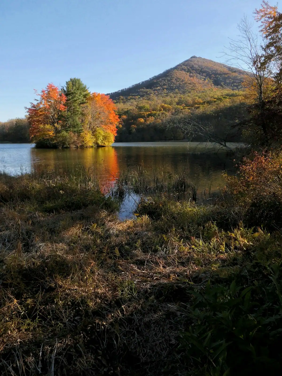
  • Still lake water holding the reflection of a wooded shoreline in autumn colour
    Landmark

    Blue Ridge Dam

    Free

    A 167-foot earth dam from 1931 that made the lake, chilled the river below it and set the rhythm of the whole county.

    0.5–1 hoursFree. No visitor centre, no tours and no facilities at the dam.2.9 mi away

    Photograph: Chief Mass Communication Specialist Scott Curtis, U.S. Navy

  • A tent pitched on a grassy site among trees at the edge of a calm lake
    Park

    Morganton Point Recreation Area

    The public way onto Lake Blue Ridge: a small sand beach, 42 forest campsites and a ramp, in a village that used to run the county.

    2–5 hoursDay-use parking fee per vehicle; camping charged per night.2.1 mi away

    Photograph: Thomson200

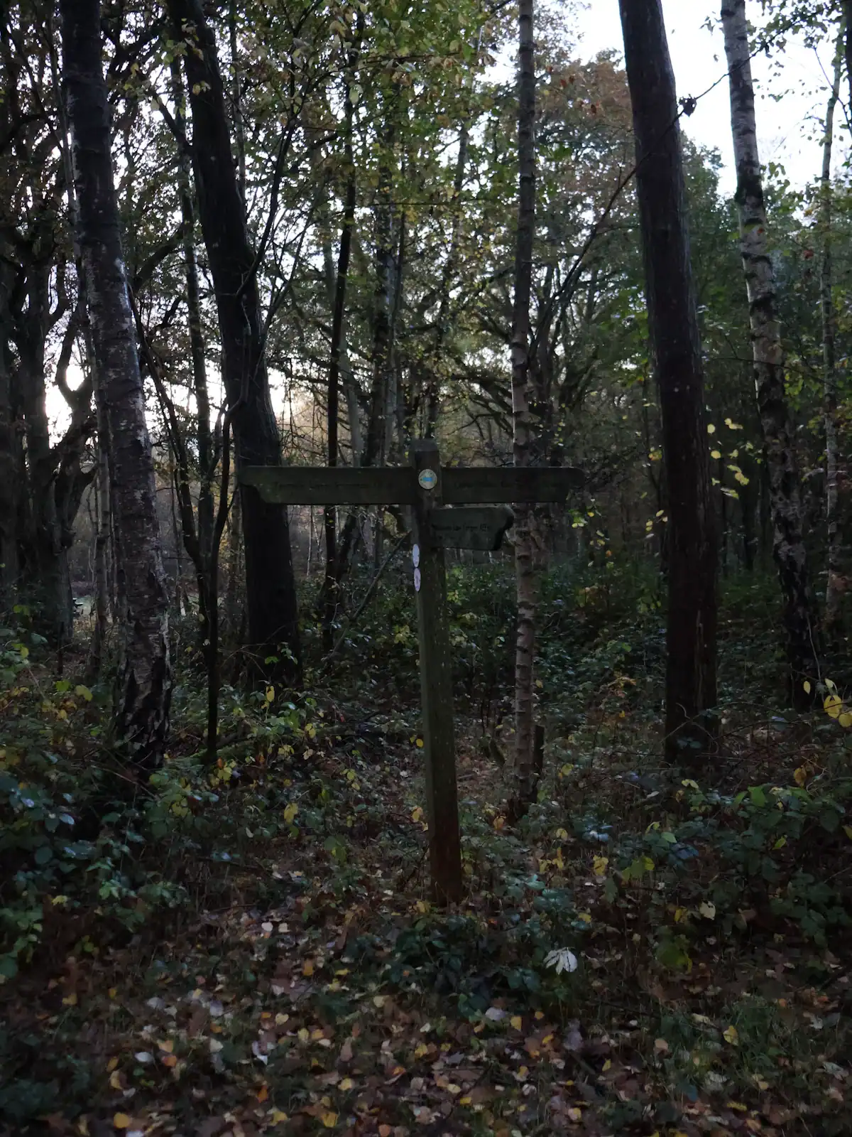
  • A wooden trail signpost standing in dense autumn woodland
    Trail

    Aska Adventure Area

    Free

    A ridge of Forest Service singletrack wedged between the lake and the river, and the closest real hiking to most Blue Ridge cabins.

    1.5–6 hoursFree. No permit, no parking fee, no facilities.3.6 mi away

    Photograph: Unsplash

The Lake: common questions

Can you swim in Lake Blue Ridge?

Yes, at your own risk, and there are no lifeguards anywhere on it. Morganton Point Recreation Area on the eastern shore has the nearest thing to a public beach. Two things surprise first-timers: the water is colder than a Georgia visitor expects because it is impounded mountain river, and it stratifies sharply, so it can be pleasant on the surface and genuinely cold a few feet down. Submerged stumps are a real hazard below full pool.

Why is the water level in Lake Blue Ridge so low in winter?

Because TVA runs it as a working reservoir for power and flood storage rather than for recreation. The lake is held near its summer full pool of roughly 1,686 feet above sea level through the warm months, then drawn down through autumn to a winter low and refilled in spring. On a steep-sided lake that exposes wide bands of clay and rock and leaves some ramps on dry ground. Check TVA's current elevation before towing a boat.

What fish are in Lake Blue Ridge?

Smallmouth bass are the headline, which is unusual this far south and reflects the fact that the lake sits in the Tennessee River drainage rather than a Gulf or Atlantic one. Walleye are present too, along with largemouth and spotted bass, panfish and catfish. Trout hold in the cold deep water and in the Toccoa both above the lake and in the tailwater below the dam. A Georgia licence is required, with a trout stamp on trout water.

Is Lake Blue Ridge surrounded by houses?

Less than most Southeastern reservoirs. A large share of the roughly sixty miles of shoreline lies inside the Chattahoochee National Forest, which means no seawalls, no lawns to the water and no development at all on those stretches. From the middle of the lake it reads as continuous forest broken by the occasional dock. That is the main reason it looks different from the reservoirs closer to Atlanta.

Where can you launch a boat on Lake Blue Ridge?

Public access is limited by design. Morganton Point Recreation Area on the eastern side has a ramp alongside its campground and beach, and there are further ramps scattered around the lake, several of which are only usable near full pool. Blue Ridge Lake Marina at the northern end near the dam is where most rental pontoons come from. Cabin docks are private and are not necessarily included with a rental.